Climadjust
Climadjust
From more frequent and intense droughts that ruin crops, to heatwaves that difficult day-to-day activities... Climate change impacts ripple across society and vary from location to location. To mitigate and adapt to these changes, climate projections provide key insights into how the climate conditions are going to evolve over the next decades.
However, the raw data provided by Global Climate Models (GCMs) or Regional Climate Models (RCMs) cannot be used directly: their resolution is usually not high enough, and certain aspects of the models are simplified (e.g. parameterisation). The result is that, while GCMs and RCMs provide a good overall picture, their outputs exhibit biases when compared with local or regional historical observations. To solve this, researchers use bias adjustment: a set of statistical techniques that allows them to use past observations to adjust future projections. This is a time- and resource-consuming process, that requires from technical knowledge.
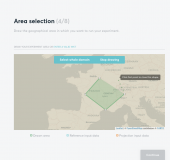
Climadjust is a web service that enables users to apply bias adjustment techniques to climate projections in a simple and validated way. Through a user-friendly interface and a set of predefined steps, the user is able to:
- Upload their own datasets of observations to adjust the projections.
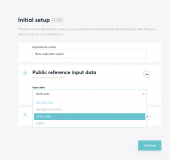
- Access state-of-the-art climate datasets coming from trusted sources like Copernicus Climate Change Service or the Earth System Grid Federation.
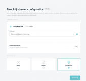
- Choose among six different state-of-the-art bias adjustment techniques.
- Obtain projections that are ready to be used, in standardised formats: JSON and NetCDF.
- Validate the bias adjustment techniques on historical periods
The service also provides API access, to be easily integrated into existing workflows.
Climadjust can be tried out for free at climadjust.com.
Key features

Detailed description
Climadjust offers worldwide coverage, enabling the user to upload their own data to adjust climate projections. For those cases when the user doesn't have data of their own, Climadjust provides access to climate datasets coming from trusted sources, such as Copernicus Climate Data Store. In particular, it offer access to:
- Projection datasets: climate projections from CMIP5 or EURO-CORDEX. Other datasets, such as CMIP6 and other CORDEX domains, are in the process of being included.
- Reference datasets: observational and reanalysed datasets such as ERA5, that provides hourly estimates of a large number of atmospheric, land and oceanic climate variables, covering from 1979 to within 5 days of real time.
To adjust the data, Climadjust employs the Bias Adjustment capabilities of the Open Access framework Climate4R, continuously maintained and updated by a dedicated community of climatologists. This allows a transparent use of climate data. In particular, Climadjust offer six different Bias Adjustment techniques, including both parametric and empirical techniques, as well as trend-preserving options:
- ISIMIP3 [1]
- Empirical Quantile Mapping [2]
- Detrended Quantile Matching [3]
- Quantile Delta Mapping [4]
- Parametric Quantile Mapping
- Generalised Parametric Quantile Mapping [5]
The validation techniques offered by Climadjust ensures that the whole process is transparent, providing verifiable processing information. The validation protocols were developed hand in hand with the Santander Meteorology Group at the University of Cantabria and follow the standard validation methods defined in the European VALUE COST.
European funding & collaboration
Climadjust was funded as a Use-Case project of the Copernicus Climate Change Service (C3S). The C3S is one of the six EU’s Copernicus Programme services implemented by the European Centre for Medium-Range Weather Forecast (ECMWF).
In addition, Climadjust was developed in collaboration with the Spanish National Research Council (CSIC), through the Santander meteorology Group.
 |  |
 |  |
Added value services
Although Climadjust can be used as a Software as a Service (SaaS), we offer additional features, to provide a more tailored service:
- Climate indexes calculation: we can provide additional support to compute climate indexes that are relevant to different sectors.
- Custom projects: from environmental studies to risk analysis, climate projections are useful to a myriad of users. We can offer a tailored apporach towards particular cases, to provide the climate data each challenge requires.
- Training: we offer tailored training to organisations that wish to integrate the service in their workflow, to exploit the full capabilities that Climadjust offers: API access, climate expertise and much more.
References and technical documentation
[1] ISIMIP3: Lange, S. (2019) . Trend-preserving bias adjustment and statistical downscaling with ISIMIP3BASD (v1.0), Geoscientific Model Development , 12: 3055–3070. doi: 10.5194/gmd-12-3055-2019
[2]Empirical Quantile Mapping: Déqué, M. (2007) . Frequency of precipitation and temperature extremes over France in an anthropogenic scenario: model results and statis-tical correction according to observed values. Global and Planetary Change , 57: 16 – 26, doi: 10.1016/j.gloplacha.2006.11.030
[3]Detrended Quantile Mapping: Cannon, A.J., S.R. Sobie and T.Q. Murdock (2015) . Bias Correction of GCM Precipitation by Quantile Mapping: How Well Do Methods Preserve Changes in Quantiles and Extremes? Journal of Climate, 28, 6938–6959, doi: 10.1175/JCLI-D-14-00754.1
[4] Quantile Delta Mapping: Cannon, A.J., S.R. Sobie and T.Q. Murdock (2015) . Bias Correction of GCM Precipitation by Quantile Mapping: How Well Do Methods Preserve Changes in Quantiles and Extremes? Journal of Climate, 28, 6938–6959, doi: 10.1175/JCLI-D-14-00754.1
[5] Generalised Parametric Quantile Mapping: Gutjahr, O. and Heinemann, G. (2013) . Comparing precipitation bias correction methods for high-resolution regional climate simulations using COSMO-CLM, Theoretical and Applied Climatology , 114, 511-529. doi: 10.1007/s00704-013-0834-z


