


From a technical viewpoint, our contribution to CLIMOS has been structured around two main pillars – the architecture of web services with automated data workflows and the development of the user interface in the Early-Warning System. Let’s take a more detailed look at them.
Climate and multi-temporal scale predictive modelling
A modelling framework was developed, divided in two different key components:
-
Short and mid-term prediction: it integrates high-resolution weather forecasts from ECMWF’s IFS system and seasonal forecasts by Copernicus Climate Change Service (C3S).
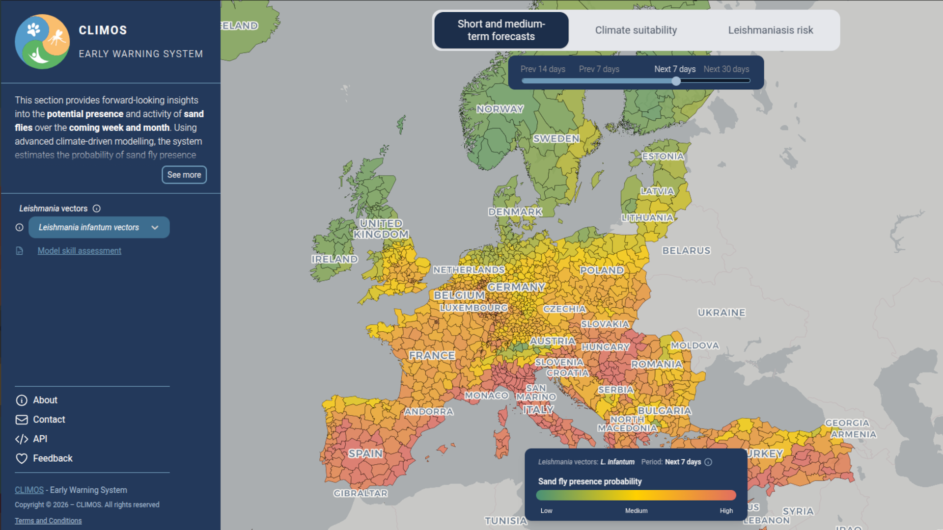
Using a two-step Machine Learning approach, the system first estimates the seasonal window of activity, and the week-to-week variability afterwards, generating occurrence local-level probability maps (classified in low, medium or high) grouped by the vector species transmitting Leishmania (L. major, L. tropica and L. infantum). -
Long-term climate suitability: it uses Machine Learning algorithms trained on historical observations (2009-2023) and projections based on IPCC climate change scenarios (RCPs and SSPs), assessing vector distribution throughout the 21st century.
In order to guarantee the operational trustworthiness of the EWS, an exhaustive validation framework has been established. Long-term climate suitability models were evaluated using multiple performance metrics against the historical reference period, confirming its robustness. Furthermore, short and mid-term predictions were validated against actual data collected during field work, showing the system’s operational capability to offer reliable predictions in nearly real time and consolidating its usefulness for decision-making.
Innovative Geo-spatial visualisation
One of the greatest technical challenges we overcame in the development of the EWS has been the efficient modelling and management of vast geographical data quantities within the user’s browser without compromising its performance.
While Geographical Information Systems typically use server-modelled raster layers and published with WMS standards, CLIMOS Early-Warning System utilises vector tiles (data fragments storing geometries such as coordinates and shapes) that are rendered in the browser.
This allows for a total interactivity (detecting events while hovering the mouse or by clicking, for instance). In order to optimise the experience changing scale (allowing to change from a NUTS3 level to a detailed city level instantly), the system pre-generates the static geometries of geographic layers at different zoom levels and fuses them with daily updated sand fly-occurrence predictions in real time.
The success of an Climate Health Early Warning System lies not only in the accuracy of its predictive models, but in its engineering capacity to process vast quantities of data daily and present them to the final user in an interactive, seamless way.