
Customisable
Through a user-friendly interface and a set of predefined steps, the user will be able to:
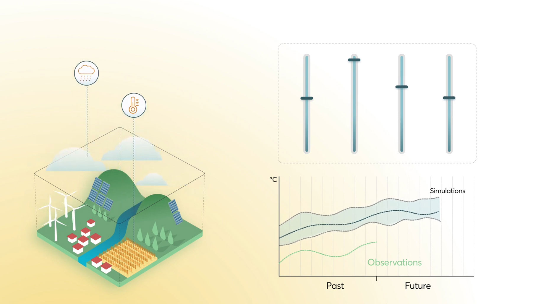
- Upload their own datasets of observations to adjust the projections.
- Access state-of-the-art climate datasets coming from trusted sources like Copernicus Climate Change Service or the Earth System Grid Federation.
- Apply state-of-the-art bias adjustment techniques.
- Obtain ready-to-use projections in simple file formats.
- Better charactersation of uncertainty by providing model ensemble information by default.
Climadjust can be tried out for free here.
Detailed description
Climadjust offers worldwide coverage and provides access to climate datasets from trusted sources, such as Copernicus Climate Data Store. In particular, it offers access to:
- Projection datasets: climate projections from CMIP6 and CORDEX.
- Reference datasets: reanalysis data from ERA5, that provides hourly estimates of a large number of atmospheric, land and oceanic climate variables, covering from 1940 to our time.
To adjust the data, Climadjust employs the Bias Adjustment capabilities of the Open Access framework Ibicus, continuously maintained and updated by a dedicated community of climatologists. This allows a transparent use of climate data. In particular, Climadjust offers the ISIMIP3 [1] Bias Adjustment technique, the same one used for IPCC's Sixth Assessment Report.
The validation techniques offered by Climadjust ensure that the whole process is transparent, providing verifiable processing information. The validation protocols were developed hand in hand with the Santander Meteorology Group at the University of Cantabria and follow the standard validation methods defined in the European VALUE COST.
European funding & collaboration
Climadjust was funded as a Use-Case project of the Copernicus Climate Change Service (C3S). The C3S is one of the six EU’s Copernicus Programme services implemented by the European Centre for Medium-Range Weather Forecast (ECMWF).
In addition, Climadjust was developed in collaboration with the Spanish National Research Council (CSIC), through the Santander meteorology Group.
Climadjust latest version has been developed thanks to project coded CPP2021-008510, funded by MCIN/AEI/10.13039/501100011033 and the European Union's “NextGenerationEU”/PRTR”.
Added value services
Although Climadjust can be used as a Software as a Service (SaaS), we offer additional features, to provide a more tailored service:
- Climate indices calculation: we can provide additional support to compute climate indices that are relevant to different sectors.
- Custom projects: from environmental studies to risk analysis, climate projections are useful to a myriad of users. We can offer a tailored approach towards particular cases, to provide the climate data each challenge requires.
- Training: we offer tailored training to organisations that wish to integrate the service in their workflow, to exploit the full capabilities that Climadjust offers: API access upon request, climate expertise and much more.
References and technical documentation
- [1] ISIMIP3: Lange, S. (2019) . Trend-preserving bias adjustment and statistical downscaling with ISIMIP3BASD (v1.0), Geoscientific Model Development , 12: 3055–3070. doi: 10.5194/gmd-12-3055-2019