AI4Clouds contributes to the evolution of Earth-System Digital Twins from weather and climate data provision towards actionable user-oriented services, including applications for solar energy operators
Combination of heterogeneous datasets
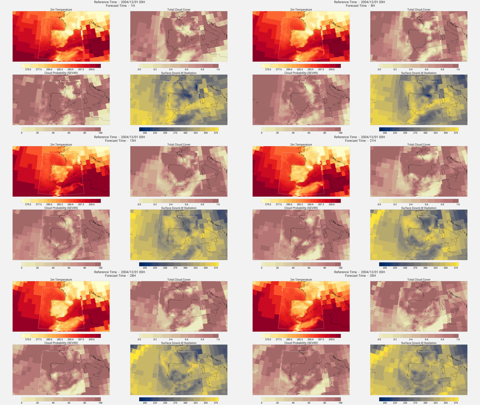
Accurate short-term cloud forecasting remains one of the main bottlenecks for solar-energy operations. In order to address that challenge, AI4Clouds is merging physics-based forecasts (Extremes DT) and reanalysis (ERA5) with high-resolution satellite cloud observations (SEVIRI and FCI), and provide Deep Learning-enhanced cloud fields required for energy-sector operation over 0–24h.
This requires combining heterogeneous datasets, handling multi-resolution grids, ensuring operational deployment in the DestinE Data Lake, DestinE’s infrastructure for data access, processing and storage, and providing robust uncertainty quantification.
AI4Clouds uses a stretched-grid Graph Neural Network–Transformer architecture, which represents atmospheric fields as connected grid points and learns their relationships across different scales. The architecture is implemented within ECMWF’s DL-based Anemoi framework, where satellite data are used as training targets and initial conditions during inference. While Extremes DT forecasts are used as training targets, at inference, its forecasts are also required to produce DL-based enhanced clouds. This makes the solution operationally aligned with Digital Twin workflows.
Validation in AQUA
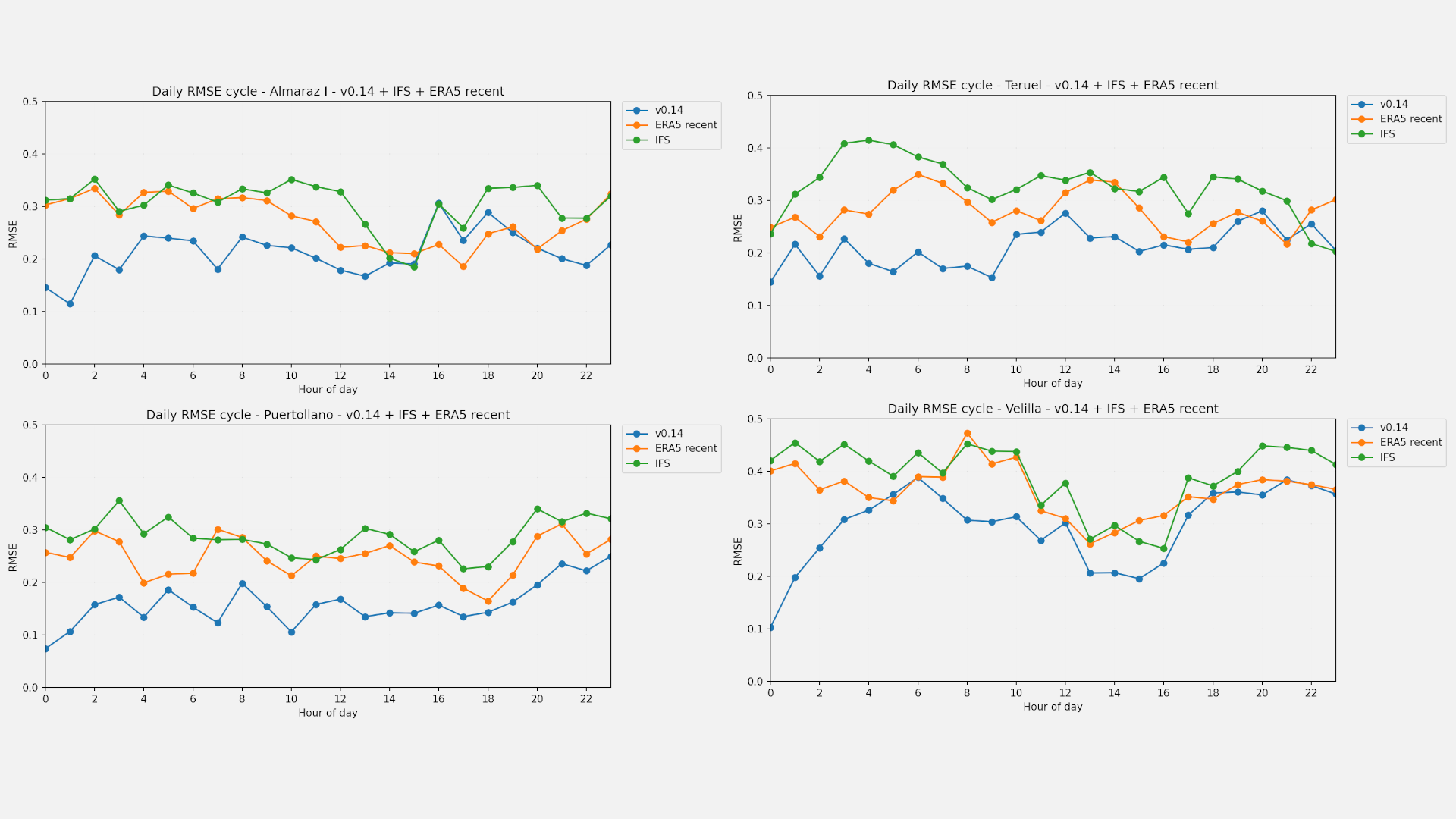
The validation was integrated into AQUA, the evaluation framework used within DestinE, and adapted to analyse short-range hourly forecasts. AI4Clouds predictions were compared against FCI satellite observations and two reference products: ERA5 and the operational IFS forecasts. The evaluation considered different metrics of error, correlation, bias and variability at several locations. In addition, a hindcast covering the 2017–2019 period was produced to assess the model over a longer period.
The results show that AI4Clouds improves total cloud cover forecasts compared with ERA5 and IFS at the locations evaluated. The improvement is larger during the first forecast hours, when the latest satellite observation contains more recent information, but it persists through most of the first 24 hours. The longer hindcast also confirms a consistent improvement over ERA5, indicating that the result is not limited to the period used in the final demonstration.
The improvements in cloud cover were also found to translate into consistent improvements in the solar-radiation diagnostic.
Scalability
By embedding DL solutions directly within DestinE’s infrastructure, AI4Clouds contributes to the evolution of Earth-System Digital Twins from weather and climate data to actionable, user-driven services, such as for solar operators.
Furthermore, it’s a scalable pattern for integrating Artificial Intelligence into DestinE, leveraging Digital Twins simulations, and a reproducible, open-source MLOps environment for developing, deploying and maintaining the models within DestinE.
Destination Earth (DestinE) is a European Union-funded initiative to build digital replicas of the Earth system. DestinE is jointly implemented by three entrusted entities: EUMETSAT, responsible for the development of the DestinE Data Lake, the European Centre for Medium-Range Weather Forecasts (ECMWF), tasked with the creation of the first two Digital Twins and the Digital Twin Engine, and the European Space Agency (ESA), responsible for building the DestinE Platform.
Find out more at destination-earth.eu.