Data Viewer
Data Viewer
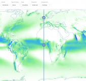
Bring climate data to life
To transform data into actionable information, they need to be conveyed in a clear manner. Our Data Viewer is a GIS product designed to showcase climate data:
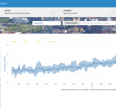
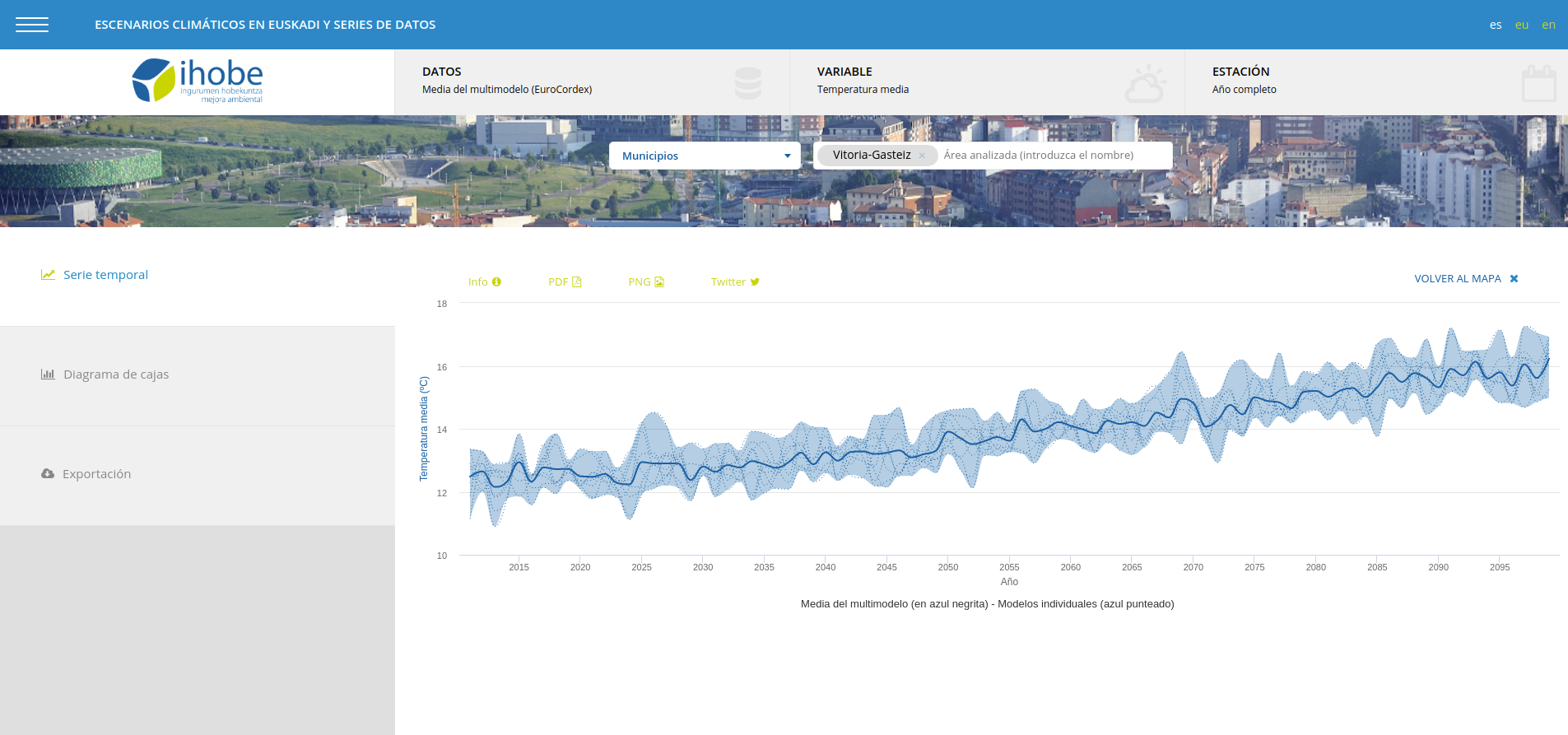
- Browse spatial and non-spatial information: For climate data, when is as important as where. Explore location-specific weather predictions, climate projections and other data by clicking on a location to see the time-series. Compare predictions computed at different times for the same time-window. Filter by location, time periods and many other parameters.
- Clean interface: we follow user-friendly and accesibility guidelines, to ease the information acquisition and provide an optimal user experience.
- Web-based solution: to guarantee cross-platform access and an easy integration into existing websites and portals.
- Plug-and-play: we follow open standards, to integrate new data in a seamless way. You provide the data, we take care of the rest.
Need more information? Drop us a line or scroll down to the technical specifications to get into details.
Key features
Clean design
Highly customisable
Plug-and-play approach
Swift and simple user experience
Technical specifications
- Open Geospatial Consortium (OGC) standards compliance: WMS, WPS, WCS or WFS
- Support for the most popular GIS and scientific formats including HDF5, NetCDF, GRIB, GeoTIFF, ShapeFIle or GeoJSON.
- High performance system able to handle very high-resolution datasets
- Support for many different Spatial Projections, Coordinate Reference Systems and Grid types
- Multi-dimensional data support
See it in action: use-cases
We have implemented different versions of our Data Viewer for several clients:
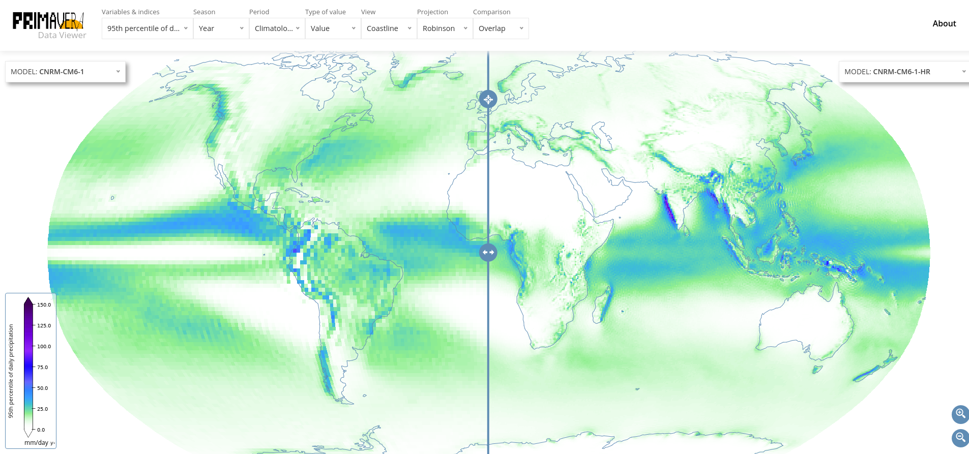
- European project Primavera: the project generated novel, well-evaluated and high-resolution global climate models. We developed the project's User Interface, with a Data Viewer that enables the user to explore the project's results. Link.
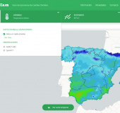
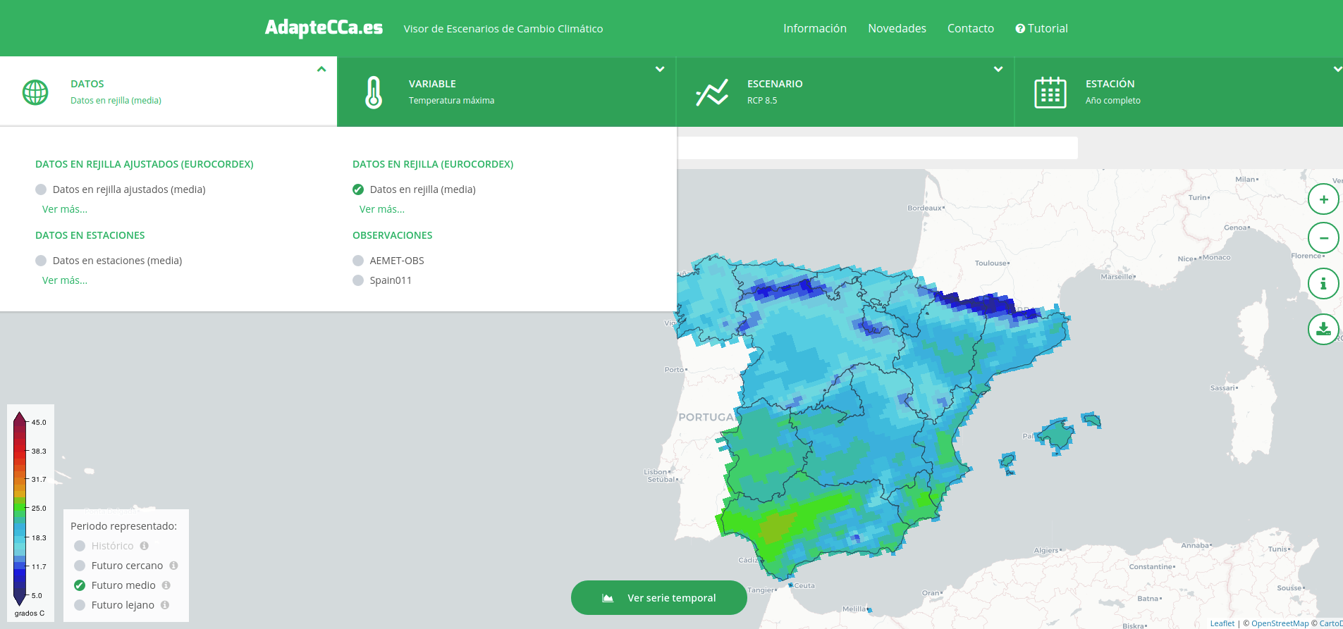
- Spanish Office for Climate Change Adaptation: we developed the portal to explore the climate change scenarios in Spain. We incorporated bias-adjusted data, as well as over 20 relevant climate indices for different sectors. Link.
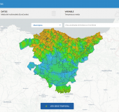
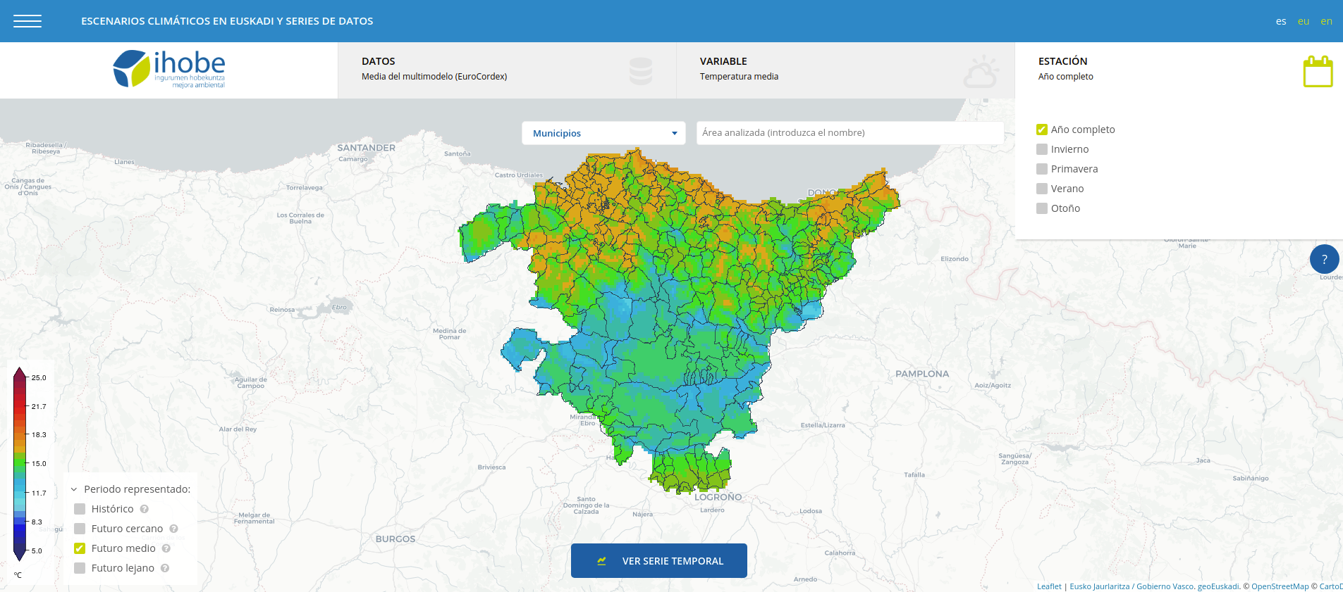
- IHOBE: To be able to navigate data at a municipal level, we developed a Data Viewer for the Public Society for environmental management of the Basque Country. Link.
Added value services
We provide additional services around this product, to cover different needs:
- Data consultancy: climate projections that need to be adjusted, calculating climate indices, complementing your dataset with additional data… we provide consultancy services so you get the most of your data.
- Data acquisition: need to explore certain data, but are unsure on where to find it? We provide access to climate data coming from trusted sources: Copernicus, NOAA, ESGF and many others. Get in touch to explore the different options you may have!
- Storytelling: data that tell a story make the most impact. Need help presenting your data to specific audiences? Our user engagement experts will help you find the best narrative to reach them.