Climate change ripples across society, affecting multiple sectors: city planning, transport, water management, agriculture, forest management and many others. On a global scale, efforts like the European Green Deal are devoting an enormous quantity of resources to fight against climate change in a way that leaves no one and no place behind. But to guide those efforts, we need reliable projections of how the climate is going to evolve, to have a better sense of the future and the changing climate we face.
Today we’re launching a new climate service to help with that: Climadjust. It allows researchers and institutions working in adaptation and mitigation strategies to obtain ready-to-use, custom climate projections. How? By letting them apply bias-adjustment techniques to their climate data in a simple manner. If you don’t know what bias adjustment is, don’t worry: we explain it below.
Climadjust has been funded by the Copernicus Climate Change Service (C3S) implemented by ECMWF. We have developed the service with the collaboration of CSIC, through the Santander Meteorology group at IFCA. Thanks to them we are able to use the well-tested Climate4R Open Access package in our service.
Go to Climadjust.com and try out the service for free.
What is bias adjustment? And why is it necessary?
To simulate the climate and project its evolution for the upcoming decades, researchers typically use Global Climate Models. These are computer simulations that grid the earth into boxes, each one dozens of kilometers across. Within each one of these boxes, the weather is simulated, to project how different climate variables evolve over time. Modelling is not perfect, though. Some aspects of the weather need to be simplified in the simultation. For example, taking into account the real orography of the Earth would cause the calculations to take a lot of time, and the costs would sky-rocket. Therefore, the regional features inside each box are averaged and smoothed. In addition, some physical phenomena within the atmosphere are too complex or are not yet very well understood. So, instead of being simulated, they are inserted as values within the simulation code, instead of being calculated as equations. This process is called parameterisation and is one of the main sources of uncertainty in climate models.
As a result, we end up with results that provide a really good global picture. They are able to reproduce climate phenomena (such as El Niño) and provide good average values over time. But, when comparing the simulation results with historical observations from specific locations, the models fail to represent the local climate conditions. Variables like temperature or precipitation levels are systematically deviated from the observations. These deviations are called biases, and are specially relevant at a local and regional scale. Let’s say that you are a public planner, looking for protective measures against flash floods that have to stay in place for the next decades. Taking the raw data from climate models, even if they resolve the relevant weather processes, can be biased when compared with historical records. So, in order to have reliable climate projections onto the future, the projections need to be adjusted, to reflect the reality. This process is called Bias adjustment.
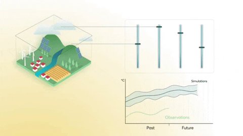
Bias adjustment techniques take into account real observations, to adjust the model outputs in the past. Depending on the climate variable to study (maximum
temperature, number of sunny days, average precipitation levels…), there are a wide range of bias adjustment methods to apply: Mean Adjustment, Parametric Quantile Mapping, Detrended Quantile Matching... Each one has to be used depending on the case to study. Extreme events and variables require a different approach than looking into average trends, for example.
The process of adjusting biases in climate data is all but easy. It’s highly technical, takes a lot of time, and requires access to efficient computational resources.
What does Climadjust offer?
To simplify the process of applying Bias Adjustment techniques to climate datasets, Climadjust enables the user to apply bias adjustment techniques to their own datasets in a simple manner:
- Gain access to climate datasets: we provide access to several projection datasets, such as CMIP5 or CORDEX-EUR-11. They come from trusted sources, such as the Copernicus Data Store or the Earth System Grid Federation. In the near future we will be incorporating CMIP6, as well as other datasets.
- Upload their own observations: to adjust the climate projections, the users can upload their own dataset of historical observations (or other types of datasets, like climate data coming from reanalysis). They can also choose among a selection datasets that we offer, like ERA5Land—a dataset facilitated by Copernicus Climate Change Service that provides hourly high resolution information of surface variables. It comprises data from 1981 up to 2-3 months before the present.
- Select the area of interest: the user analyses only the area that their interested in. They can select it by drawing on a map, or provide an WKT to define a precise geographical coverage.
- Choose among 6 state-of-the-art bias adjustment techniques: we include parametric and empirical methods, as well as trend-preserving options.
- Validate the results: thanks to our collaboration with the Santander Meteorology Group at CSIC, we offer scientific validation of the output, to guarantee that the results are reliable and ready to be used.
The service can be used through its user-friendly web interface, following a guided, step-by-step process. For more advanced users, there’s an API that facilitates the integration of the service into existing workflows.
After several months of hard work, we are proud to finally unveil a service that we hope will be very useful to those working on climate change adaptation and mitigation. Data providers, modellers, environmental experts, policy makers... together, we can all contribute to create more resilient societies towards climate change. Climadjust in a small contribution into having more accurate climate data that guide those steps.